")
A forestry technician uses a HOTUS rugged tablet with a laser rangefinder to measure a wood chip stockpile for carbon removal verification.
Forest‑based carbon removal projects generate credits from harvested wood that is stored or converted to biochar. But the biomass inventory – how many tonnes are actually in a stockpile – is often estimated with a tape measure and a calculator. A 10% error in volume means a 10% error in carbon credits. You need a rugged Windows tablet with a laser rangefinder and volume calculation software, logging each measurement with GPS. In carbon removal, your stockpile tonnage is your revenue. Your tablet is the accountant.
Carbon Removal Forestry LiDAR Penetration Is Low – Your Biomass Stockpile Log Needs A Rugged Windows Tablet
By HOTUS Technology | May 2026
The Technical Challenges of Volumetric Biomass Auditing in Forestry Offsets
Industrial forest-based carbon removal systems play a critical role in global climate mitigation strategies. By converting residual forest biomass into stable biochar via pyrolysis or placing harvested timber into engineered, anaerobic wood vaults, these projects isolate atmospheric carbon dioxide ($ \text{CO}_2 $) for centuries. However, the financial and regulatory viability of these ecological assets depends on precise volumetric calculations. Registries require verifiable evidence of physical fiber tonnage before issuing high-value carbon removal certificates.
Quantifying un-comminuted logs or bulk wood chip stockpiles in the field presents significant measurement challenges. Canopy cover blocks overhead satellite imaging, while ground moisture and dust scatter low-power optical sensors. For carbon offset developers sourcing reliable hardware from an established HOTUS Industrial Manufacturing: Custom Mini PCs, Rugged Tablets, and Smart Projectors supplier, replacing manual field estimates with high-accuracy, rugged computing platforms is essential to protecting inventory data and passing strict verification audits.
The Structural Pitfalls of Manual Geometry Profiling and Paper Logs
Traditional field profiling techniques for irregular, non-uniform biomass stockpiles are highly prone to human error. Field crews typically estimate pile dimensions using basic measuring wheels, manual optical rangefinders, and standard tape measures. Technicians take baseline length and width readings, estimate average height across uneven surfaces, and apply standard geometric formulas to approximate total bulk volume.
This simplified approach routinely introduces errors of 10% to 20%, as it fails to account for structural shifting, uneven terrain, or varying compaction densities across the pile profile. Recording these inaccurate calculations on paper forms introduces further risk. Paper logs degrade quickly when exposed to rain, mud, and extreme temperatures on logging sites. More importantly, static paper records offer no verifiable proof of data integrity, lacks spatial metadata, and lacks time-stamped geotags, leaving project developers vulnerable to major credit adjustments during independent registry audits.
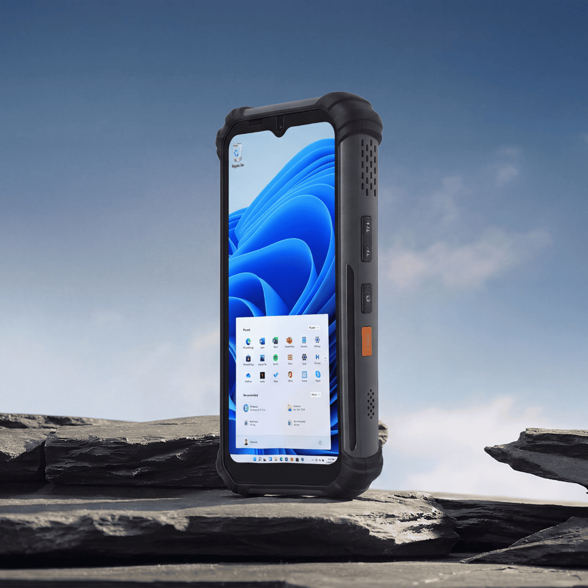
Precision Volumetric Inversion: Deploying the HOTUS ST11-U in Remote Forests
Integrating the Hotus ST11‑U 10.1″ Windows rugged tablet into field auditing workflows eliminates the guesswork from biomass inventory management. Protected by an IP67-rated, impact-resistant structural enclosure, the ST11-U operates reliably in extreme temperatures and dusty clearings. The tablet features a high-brightness, outdoor-viewable touch screen that handles rain and mud seamlessly, enabling field crews to capture precise volumetric data directly at the stockpile face. Running professional spatial modeling software on Windows, the ST11-U automates data collection:
- Multi-Point Laser Triangulation: The system connects via industrial Bluetooth to long-range digital distance meters, capturing precise coordinate points across irregular stockpile surfaces to map true topography.
- Spatial Footprint Mapping: High-precision internal GNSS modules log exact polygon coordinates around the base of the pile, isolating storage volumes from uneven ground contours.
- Real-Time Confidence Checks: Integrated algorithms evaluate point-cloud density on the fly, alerting the operator if measurement variations exceed a 5% margin so they can re-scan immediately.
Once the spatial model is complete, the ST11-U applies species-specific moisture and density values to convert raw volume into dry metric tonnes. The finalized data set is bundled with automated time-stamps and site photos, creating a secure, tamper-evident log ready for registry review.
")
The SH5‑W tablet displays a 3D model of a wood chip pile with calculated volume and estimated dry tonnes.
Agile Tracking via the HOTUS SH5-W Rugged Handheld
For rapid inspection tasks and tracking haul trucks across vast forest sectors, the Hotus SH5‑W Windows rugged handheld offers exceptional field mobility. Designed to withstand rough handling and frequent drops onto rocky terrain, the SH5-W fits easily into a cruiser vest pocket.
The handheld device allows field supervisors to cross-verify incoming feedstock receipts, log active truck scale weights, and track wood species distributions across multiple staging sites. Real-time data synchronization ensures that variations in bulk density factors are updated instantly across the project database, maintaining calculation accuracy before volumetric data is finalized.
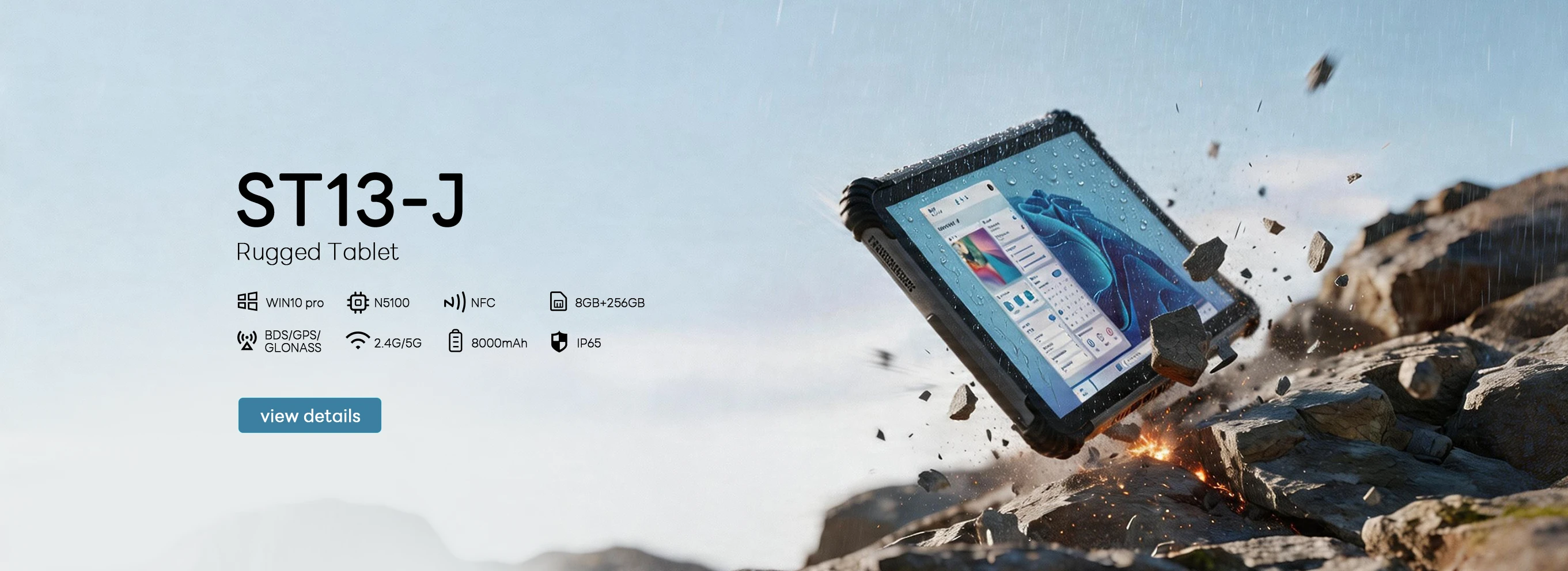
Multi-Site Inventory Aggregation: The HOTUS ST13-J Enterprise Dashboard
When matching field inventory data with carbon credit accounting across multiple remote properties, the Hotus ST13‑J 13.3″ Windows rugged tablet serves as the central operations terminal. Equipped with a large, sunlight-readable display and a powerful Intel processor, the ST13-J aggregates data streams from every deployed ST11-U and SH5-W unit via secure cellular or satellite links.
The ST13-J control panel tracks total biomass inventory, active accumulation rates, and projected credit yields across all sites. When validation bodies conduct carbon registry audits, compliance managers can access the raw laser data, spatial models, and geotags for any individual pile directly from the screen, providing a transparent, unalterable data trail that accelerates certificate issuance.
Financial Performance Impact: Recovering Hidden Environmental Revenue
The commercial advantage of moving away from manual estimation methods is demonstrated by a regional carbon removal forestry project managing 20 separate bulk biomass stockpiles. Previously relying on manual measuring wheels and paper logs, the project experienced volume estimation errors averaging 12% due to irregular pile geometry and slope changes. To fix this, the company deployed 10 ST11-U tablets, 15 SH5-W handhelds, and 8 ST13-J tablets across its field sites.
In the first year of operation, the digital laser triangulation system reduced volumetric estimation errors down to less than 3%. The increased accuracy revealed an additional 1,500 tonnes of sequestered $ \text{CO}_2 $ biomass that had been completely overlooked by traditional manual calculations. At a market value of $150 per credit tonne, this adjustment generated $225,000 in previously uncaptured revenue. Furthermore, the complete, tamper-evident digital records allowed the operation to clear its third-party verification audits ahead of schedule, avoiding costly project review delays.
")
The ST13‑J dashboard displays total biomass inventory across multiple sites, with a pie chart of feedstock types and a map of pile locations.
Securing Carbon Asset Value with Professional Field Hardware
In high-value carbon offset markets, precise inventory tracking is critical to financial performance. Relying on basic tape measures and manual paper entries introduces unacceptable financial risk. Upgrading to rugged Windows tablets equipped with laser spatial mapping software provides the measurement precision and transparency that modern carbon registries demand.
By matching multi-point laser data with secure cloud accounting via the Hotus ST11-U, SH5-W, and ST13-J, carbon project developers can eliminate measurement errors, secure full credit values, and streamline compliance audits. Protect your environmental assets from valuation errors with rugged field computing solutions engineered for demanding remote operations.
Ready to Safeguard Your Carbon Removal Inventory Data?
Contact our industrial hardware engineers today to request complete system specifications, review wireless sensor integration profiles, or coordinate a field pilot deployment for your remote logging operations.
Contact HOTUS Technology